


 关联应用
关联应用
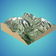
3D GIS Digital Elevation Model
Real-World Data Digital Model
开发者: Andres Narvaez
中国

版本统计
1418天20小时
最新版本上线距今
0
近1年版本更新次数
2021-06-15
全球最早版本上线日期
版本记录
版本: 1.1
版本更新日期
2021-09-21

3D GIS Digital Elevation Model
Real-World Data Digital Model
更新日志
Added Free Trial.
Huge bug fixes.应用描述
Quickly generate 3D models:
Directly from the internet; Bing Maps, Mapbox, and ArcGIS or from a cloud point stored locally.
Export real data:
From point cloud data in CSV or TXT to 3D models in STL or OBJ and satellite images.
Operate:
Cut, re-scale, and animate models for representation, analysis, and calculations.
Compute operations:
Calculate surface areas and volumes of a model in real-world units with little difference compared to ArcGIS.
Explore:
Character controller geo positioned in real-world coordinate systems such as UTM and Geographic Coordinate System.预订版本: 1.0
版本更新日期
2021-06-15
预订转上架日期
2021-06-15
3D GIS Digital Elevation Model
Real-World Data Digital Model
更新日志
暂无更新日志数据
应用描述
暂无应用描述数据


微信公众号

七麦数据公众号

七麦研究院公众号
APP下载
- IOS
- Android

@2014-2022 qimai.cn,北京七麦科技股份有限公司 All Rights Reserved. 京ICP备14049953号
 京公网安备 11010502041000号


