


 关联应用
关联应用

Iphigénie | The Hiking Map App
IGN maps, hiking, outdoor
开发者: Iphigenie

6天1小时
最新版本上线距今
20
近1年版本更新次数
2010-04-05
全球最早版本上线日期
版本: 14.3.3
版本更新日期
2025-07-03
Iphigénie | The Hiking Map App
IGN maps, hiking, outdoor
更新日志
New maps in the Italy subscription!
- Il Lupo maps: Central and southern Apennines,
- Geo4Map maps: Northwestern and southern Italy.视频/截图
应用描述
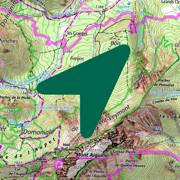
Iphigénie is the hiking map app for outdoor enthusiasts in France and around the world. Perfect for individuals (hikers, trailers, bikers, horse riders…) and professionals (guides, firefighters, surveyors, airmen, sailors, etc.) who need accurate maps.
Find more than 40 detailed topographic basemaps (including IGN maps, SwissTopo, IGN Spain, OpenTopo, OpenSnow, land registry, slope inclination), even while offline.
BEFORE YOUR OUTING
- Prepare your outing by downloading maps to access them offline
- Create, edit and import tracks
- Create and import markers (e.g. mushroom spots, departure points of routes, etc.)
- Print sections of the map if you need to
- Search for a specific location by name or by GPS details
- Access routes or landmarks from IGNRando or Data-Avalanche
- Access a 3D view and slope inclinations
DURING YOUR OUTING
- Geolocate yourself on the basemap of your choice
- Follow routes using GPS, without worrying about network availability
- Record your track
- Access real-time information such as distance traveled, elevation (±), average speed, current speed, estimated time of arrival, etc.
- Activate the beacon function to allow your loved ones to follow your progress in real-time
- Create specific voice alerts to guide you, even with your iPhone in your pocket
AFTER YOUR OUTING
- Create groups of tracks/landmarks
- Store and backup all your data in the Cloud
- Export your GPS tracks and landmarks in GPX format
- Share your outings and landmarks with all your friends
What our customers say about us:
" Thanks to Iphigénie, I discover a lot of amazing new places. I note the slopes, the summits, the lakes... It saves me precious time, especially in remote places where there are very few indications and markings! ".
In the press :
20 minutes: " Hiking, like outdoor activities, has not missed the digital shift, as Alice (25) comments. "It's hugely appreciated to be able to check accurate IGN maps, including when you no longer have a connection, as happens a lot in the high mountains".
Download the free basic app
Download the basic application for free on your smartphone. This version allows you to be geolocated on one of the 25 free base maps such as Open Topo Map, Open Cycle Map, Open Snow map. The world is within reach!
You will also have access to real-time information such as your position/course/altitude/speed.
Use the complete app with the “Iphigénie Carto” subscription
The Iphigénie Carto subscription is €24.99 per year. It gives you access to 40 base maps including those of IGN. These maps can be downloaded on your device (iPhone, iPad, iPod, Watch) so that you can access them even without a network.
You also have access to the full potential of Iphigénie by finding all the features mentioned above.
Good to know: you have 7 days to test the complete app for free.
Use the high quality Italian map with the ‘Maps of the Italian Alps’ subscription
You can buy Fraternali's 1:25,000 Italian topographic maps for €24.99 a year. This subscription gives you access to accurate, information-packed digital maps covering the western Italian Alps.
List of available maps:
- IGN France
- SwissTopo
- Fraternali
- IGN Spain
- IGN Belgium
- BKG Germany
- Kartverket Norway
- Cartographic Institute of Catalunya
- OpenTopo
- OpenCycle
- OpenSnow
- ICAO
- ESRI
- Satellite view
- Cadastre
- Slope inclination
- Restricted areas for drones
- Historical maps of France
- Geological and mining maps (France)
- National Forestry Office
We donate 1% of our turnover to 1% for the Planet to help preserve the environment.
MADE IN FRANCE
版本: 14.3.2
版本更新日期
2025-06-26

Iphigénie | The Hiking Map App
IGN maps, hiking, outdoor
更新日志
contains several bug fixes视频/截图
应用描述
Iphigénie is the hiking map app for outdoor enthusiasts in France and around the world. Perfect for individuals (hikers, trailers, bikers, horse riders…) and professionals (guides, firefighters, surveyors, airmen, sailors, etc.) who need accurate maps.
Find more than 40 detailed topographic basemaps (including IGN maps, SwissTopo, IGN Spain, OpenTopo, OpenSnow, land registry, slope inclination), even while offline.
BEFORE YOUR OUTING
- Prepare your outing by downloading maps to access them offline
- Create, edit and import tracks
- Create and import markers (e.g. mushroom spots, departure points of routes, etc.)
- Print sections of the map if you need to
- Search for a specific location by name or by GPS details
- Access routes or landmarks from IGNRando or Data-Avalanche
- Access a 3D view and slope inclinations
DURING YOUR OUTING
- Geolocate yourself on the basemap of your choice
- Follow routes using GPS, without worrying about network availability
- Record your track
- Access real-time information such as distance traveled, elevation (±), average speed, current speed, estimated time of arrival, etc.
- Activate the beacon function to allow your loved ones to follow your progress in real-time
- Create specific voice alerts to guide you, even with your iPhone in your pocket
AFTER YOUR OUTING
- Create groups of tracks/landmarks
- Store and backup all your data in the Cloud
- Export your GPS tracks and landmarks in GPX format
- Share your outings and landmarks with all your friends
What our customers say about us:
" Thanks to Iphigénie, I discover a lot of amazing new places. I note the slopes, the summits, the lakes... It saves me precious time, especially in remote places where there are very few indications and markings! ".
In the press :
20 minutes: " Hiking, like outdoor activities, has not missed the digital shift, as Alice (25) comments. "It's hugely appreciated to be able to check accurate IGN maps, including when you no longer have a connection, as happens a lot in the high mountains".
Download the free basic app
Download the basic application for free on your smartphone. This version allows you to be geolocated on one of the 25 free base maps such as Open Topo Map, Open Cycle Map, Open Snow map. The world is within reach!
You will also have access to real-time information such as your position/course/altitude/speed.
Use the complete app with the “Iphigénie Carto” subscription
The Iphigénie Carto subscription is €24.99 per year. It gives you access to 40 base maps including those of IGN. These maps can be downloaded on your device (iPhone, iPad, iPod, Watch) so that you can access them even without a network.
You also have access to the full potential of Iphigénie by finding all the features mentioned above.
Good to know: you have 7 days to test the complete app for free.
Use the high quality Italian map with the ‘Maps of the Italian Alps’ subscription
You can buy Fraternali's 1:25,000 Italian topographic maps for €24.99 a year. This subscription gives you access to accurate, information-packed digital maps covering the western Italian Alps.
List of available maps:
- IGN France
- SwissTopo
- Fraternali
- IGN Spain
- IGN Belgium
- BKG Germany
- Kartverket Norway
- Cartographic Institute of Catalunya
- OpenTopo
- OpenCycle
- OpenSnow
- ICAO
- ESRI
- Satellite view
- Cadastre
- Slope inclination
- Restricted areas for drones
- Historical maps of France
- Geological and mining maps (France)
- National Forestry Office
We donate 1% of our turnover to 1% for the Planet to help preserve the environment.
MADE IN FRANCE
版本: 14.3.1
版本更新日期
2025-05-07

Iphigénie | The Hiking Map App
IGN maps, hiking, outdoor
更新日志
Minor version that restores some features:
- Reworked HD option
- New elevation grid for 3D that covers a wider range
Also contains several bug fixes视频/截图
应用描述
Iphigénie is the hiking map app for outdoor enthusiasts in France and around the world. Perfect for individuals (hikers, trailers, bikers, horse riders…) and professionals (guides, firefighters, surveyors, airmen, sailors, etc.) who need accurate maps.
Find more than 40 detailed topographic basemaps (including IGN maps, SwissTopo, IGN Spain, OpenTopo, OpenSnow, land registry, slope inclination), even while offline.
BEFORE YOUR OUTING
- Prepare your outing by downloading maps to access them offline
- Create, edit and import tracks
- Create and import markers (e.g. mushroom spots, departure points of routes, etc.)
- Print sections of the map if you need to
- Search for a specific location by name or by GPS details
- Access routes or landmarks from IGNRando or Data-Avalanche
- Access a 3D view and slope inclinations
DURING YOUR OUTING
- Geolocate yourself on the basemap of your choice
- Follow routes using GPS, without worrying about network availability
- Record your track
- Access real-time information such as distance traveled, elevation (±), average speed, current speed, estimated time of arrival, etc.
- Activate the beacon function to allow your loved ones to follow your progress in real-time
- Create specific voice alerts to guide you, even with your iPhone in your pocket
AFTER YOUR OUTING
- Create groups of tracks/landmarks
- Store and backup all your data in the Cloud
- Export your GPS tracks and landmarks in GPX format
- Share your outings and landmarks with all your friends
What our customers say about us:
" Thanks to Iphigénie, I discover a lot of amazing new places. I note the slopes, the summits, the lakes... It saves me precious time, especially in remote places where there are very few indications and markings! ".
In the press :
20 minutes: " Hiking, like outdoor activities, has not missed the digital shift, as Alice (25) comments. "It's hugely appreciated to be able to check accurate IGN maps, including when you no longer have a connection, as happens a lot in the high mountains".
Download the free basic app
Download the basic application for free on your smartphone. This version allows you to be geolocated on one of the 25 free base maps such as Open Topo Map, Open Cycle Map, Open Snow map. The world is within reach!
You will also have access to real-time information such as your position/course/altitude/speed.
Use the complete app with the “Iphigénie Carto” subscription
The Iphigénie Carto subscription is €24.99 per year. It gives you access to 40 base maps including those of IGN. These maps can be downloaded on your device (iPhone, iPad, iPod, Watch) so that you can access them even without a network.
You also have access to the full potential of Iphigénie by finding all the features mentioned above.
Good to know: you have 7 days to test the complete app for free.
Use the high quality Italian map with the ‘Maps of the Italian Alps’ subscription
You can buy Fraternali's 1:25,000 Italian topographic maps for €24.99 a year. This subscription gives you access to accurate, information-packed digital maps covering the western Italian Alps.
List of available maps:
- IGN France
- SwissTopo
- Fraternali
- IGN Spain
- IGN Belgium
- BKG Germany
- Kartverket Norway
- Cartographic Institute of Catalunya
- OpenTopo
- OpenCycle
- OpenSnow
- ICAO
- ESRI
- Satellite view
- Cadastre
- Slope inclination
- Restricted areas for drones
- Historical maps of France
- Geological and mining maps (France)
- National Forestry Office
We donate 1% of our turnover to 1% for the Planet to help preserve the environment.
MADE IN FRANCE
版本: 14.3
版本更新日期
2025-04-01
Iphigénie | The Hiking Map App
IGN maps, hiking, outdoor
更新日志
Apple watch bug fix : Start a track on watch is now possible for new watch models
Add new maps and layers :
- Cassini historical map
- Biodiv' layer视频/截图
应用描述
Iphigénie is the hiking map app for outdoor enthusiasts in France and around the world. Perfect for individuals (hikers, trailers, bikers, horse riders…) and professionals (guides, firefighters, surveyors, airmen, sailors, etc.) who need accurate maps.
Find more than 40 detailed topographic basemaps (including IGN maps, SwissTopo, IGN Spain, OpenTopo, OpenSnow, land registry, slope inclination), even while offline.
BEFORE YOUR OUTING
- Prepare your outing by downloading maps to access them offline
- Create, edit and import tracks
- Create and import markers (e.g. mushroom spots, departure points of routes, etc.)
- Print sections of the map if you need to
- Search for a specific location by name or by GPS details
- Access routes or landmarks from IGNRando or Data-Avalanche
- Access a 3D view and slope inclinations
DURING YOUR OUTING
- Geolocate yourself on the basemap of your choice
- Follow routes using GPS, without worrying about network availability
- Record your track
- Access real-time information such as distance traveled, elevation (±), average speed, current speed, estimated time of arrival, etc.
- Activate the beacon function to allow your loved ones to follow your progress in real-time
- Create specific voice alerts to guide you, even with your iPhone in your pocket
AFTER YOUR OUTING
- Create groups of tracks/landmarks
- Store and backup all your data in the Cloud
- Export your GPS tracks and landmarks in GPX format
- Share your outings and landmarks with all your friends
What our customers say about us:
" Thanks to Iphigénie, I discover a lot of amazing new places. I note the slopes, the summits, the lakes... It saves me precious time, especially in remote places where there are very few indications and markings! ".
In the press :
20 minutes: " Hiking, like outdoor activities, has not missed the digital shift, as Alice (25) comments. "It's hugely appreciated to be able to check accurate IGN maps, including when you no longer have a connection, as happens a lot in the high mountains".
Download the free basic app
Download the basic application for free on your smartphone. This version allows you to be geolocated on one of the 25 free base maps such as Open Topo Map, Open Cycle Map, Open Snow map. The world is within reach!
You will also have access to real-time information such as your position/course/altitude/speed.
Use the complete app with the “Iphigénie Carto” subscription
The Iphigénie Carto subscription is €24.99 per year. It gives you access to 40 base maps including those of IGN. These maps can be downloaded on your device (iPhone, iPad, iPod, Watch) so that you can access them even without a network.
You also have access to the full potential of Iphigénie by finding all the features mentioned above.
Good to know: you have 7 days to test the complete app for free.
Use the high quality Italian map with the ‘Maps of the Italian Alps’ subscription
You can buy Fraternali's 1:25,000 Italian topographic maps for €24.99 a year. This subscription gives you access to accurate, information-packed digital maps covering the western Italian Alps.
List of available maps:
- IGN France
- SwissTopo
- Fraternali
- IGN Spain
- IGN Belgium
- BKG Germany
- Kartverket Norway
- Cartographic Institute of Catalunya
- OpenTopo
- OpenCycle
- OpenSnow
- ICAO
- ESRI
- Satellite view
- Cadastre
- Slope inclination
- Restricted areas for drones
- Historical maps of France
- Geological and mining maps (France)
- National Forestry Office
We donate 1% of our turnover to 1% for the Planet to help preserve the environment.
MADE IN FRANCE
版本: 14.2.6
版本更新日期
2025-03-12

Iphigénie | The Hiking Map App
IGN maps, hiking, outdoor
更新日志
Bug fixes and performance improvements to enhance your experience.视频/截图
应用描述
Iphigénie is the hiking map app for outdoor enthusiasts in France and around the world. Perfect for individuals (hikers, trailers, bikers, horse riders…) and professionals (guides, firefighters, surveyors, airmen, sailors, etc.) who need accurate maps.
Find more than 40 detailed topographic basemaps (including IGN maps, SwissTopo, IGN Spain, OpenTopo, OpenSnow, land registry, slope inclination), even while offline.
BEFORE YOUR OUTING
- Prepare your outing by downloading maps to access them offline
- Create, edit and import tracks
- Create and import markers (e.g. mushroom spots, departure points of routes, etc.)
- Print sections of the map if you need to
- Search for a specific location by name or by GPS details
- Access routes or landmarks from IGNRando or Data-Avalanche
- Access a 3D view and slope inclinations
DURING YOUR OUTING
- Geolocate yourself on the basemap of your choice
- Follow routes using GPS, without worrying about network availability
- Record your track
- Access real-time information such as distance traveled, elevation (±), average speed, current speed, estimated time of arrival, etc.
- Activate the beacon function to allow your loved ones to follow your progress in real-time
- Create specific voice alerts to guide you, even with your iPhone in your pocket
AFTER YOUR OUTING
- Create groups of tracks/landmarks
- Store and backup all your data in the Cloud
- Export your GPS tracks and landmarks in GPX format
- Share your outings and landmarks with all your friends
What our customers say about us:
" Thanks to Iphigénie, I discover a lot of amazing new places. I note the slopes, the summits, the lakes... It saves me precious time, especially in remote places where there are very few indications and markings! ".
In the press :
20 minutes: " Hiking, like outdoor activities, has not missed the digital shift, as Alice (25) comments. "It's hugely appreciated to be able to check accurate IGN maps, including when you no longer have a connection, as happens a lot in the high mountains".
Download the free basic app
Download the basic application for free on your smartphone. This version allows you to be geolocated on one of the 25 free base maps such as Open Topo Map, Open Cycle Map, Open Snow map. The world is within reach!
You will also have access to real-time information such as your position/course/altitude/speed.
Use the complete app with the “Iphigénie Carto” subscription
The Iphigénie Carto subscription is €24.99 per year. It gives you access to 40 base maps including those of IGN. These maps can be downloaded on your device (iPhone, iPad, iPod, Watch) so that you can access them even without a network.
You also have access to the full potential of Iphigénie by finding all the features mentioned above.
Good to know: you have 7 days to test the complete app for free.
Use the high quality Italian map with the ‘Maps of the Italian Alps’ subscription
You can buy Fraternali's 1:25,000 Italian topographic maps for €24.99 a year. This subscription gives you access to accurate, information-packed digital maps covering the western Italian Alps.
List of available maps:
- IGN France
- SwissTopo
- Fraternali
- IGN Spain
- IGN Belgium
- BKG Germany
- Kartverket Norway
- Cartographic Institute of Catalunya
- OpenTopo
- OpenCycle
- OpenSnow
- ICAO
- ESRI
- Satellite view
- Cadastre
- Slope inclination
- Restricted areas for drones
- Historical maps of France
- Geological and mining maps (France)
- National Forestry Office
We donate 1% of our turnover to 1% for the Planet to help preserve the environment.
MADE IN FRANCE
版本: 14.2.5
版本更新日期
2025-02-27
Iphigénie | The Hiking Map App
IGN maps, hiking, outdoor
更新日志
Bug fixes and performance improvements to enhance your experience.应用描述
暂无应用描述数据
版本: 14.2.4
版本更新日期
2025-01-28

Iphigénie | The Hiking Map App
IGN maps, hiking, outdoor
更新日志
Bug fixes and performance improvements to enhance your experience.视频/截图
应用描述
Iphigénie is the hiking map app for outdoor enthusiasts in France and around the world. Perfect for individuals (hikers, trailers, bikers, horse riders…) and professionals (guides, firefighters, surveyors, airmen, sailors, etc.) who need accurate maps.
Find more than 40 detailed topographic basemaps (including IGN maps, SwissTopo, IGN Spain, OpenTopo, OpenSnow, land registry, slope inclination), even while offline.
BEFORE YOUR OUTING
- Prepare your outing by downloading maps to access them offline
- Create, edit and import tracks
- Create and import markers (e.g. mushroom spots, departure points of routes, etc.)
- Print sections of the map if you need to
- Search for a specific location by name or by GPS details
- Access routes or landmarks from IGNRando or Data-Avalanche
- Access a 3D view and slope inclinations
DURING YOUR OUTING
- Geolocate yourself on the basemap of your choice
- Follow routes using GPS, without worrying about network availability
- Record your track
- Access real-time information such as distance traveled, elevation (±), average speed, current speed, estimated time of arrival, etc.
- Activate the beacon function to allow your loved ones to follow your progress in real-time
- Create specific voice alerts to guide you, even with your iPhone in your pocket
AFTER YOUR OUTING
- Create groups of tracks/landmarks
- Store and backup all your data in the Cloud
- Export your GPS tracks and landmarks in GPX format
- Share your outings and landmarks with all your friends
What our customers say about us:
" Thanks to Iphigénie, I discover a lot of amazing new places. I note the slopes, the summits, the lakes... It saves me precious time, especially in remote places where there are very few indications and markings! ".
In the press :
20 minutes: " Hiking, like outdoor activities, has not missed the digital shift, as Alice (25) comments. "It's hugely appreciated to be able to check accurate IGN maps, including when you no longer have a connection, as happens a lot in the high mountains".
Download the free basic app
Download the basic application for free on your smartphone. This version allows you to be geolocated on one of the 25 free base maps such as Open Topo Map, Open Cycle Map, Open Snow map. The world is within reach!
You will also have access to real-time information such as your position/course/altitude/speed.
Use the complete app with the “Iphigénie Carto” subscription
The Iphigénie Carto subscription is €24.99 per year. It gives you access to 40 base maps including those of IGN. These maps can be downloaded on your device (iPhone, iPad, iPod, Watch) so that you can access them even without a network.
You also have access to the full potential of Iphigénie by finding all the features mentioned above.
Good to know: you have 7 days to test the complete app for free.
Use the high quality Italian map with the ‘Maps of the Italian Alps’ subscription
You can buy Fraternali's 1:25,000 Italian topographic maps for €24.99 a year. This subscription gives you access to accurate, information-packed digital maps covering the western Italian Alps.
List of available maps:
- IGN France
- SwissTopo
- Fraternali
- IGN Spain
- IGN Belgium
- BKG Germany
- Kartverket Norway
- Cartographic Institute of Catalunya
- OpenTopo
- OpenCycle
- OpenSnow
- ICAO
- ESRI
- Satellite view
- Cadastre
- Slope inclination
- Restricted areas for drones
- Historical maps of France
- Geological and mining maps (France)
- National Forestry Office
We donate 1% of our turnover to 1% for the Planet to help preserve the environment.
MADE IN FRANCE
版本: 14.2.3
版本更新日期
2025-01-07

Iphigénie | The Hiking Map App
IGN maps, hiking, outdoor
更新日志
Bug fixes and performance improvements to enhance your experience.视频/截图
应用描述
Iphigénie is the hiking map app for outdoor enthusiasts in France and around the world. Perfect for individuals (hikers, trailers, bikers, horse riders…) and professionals (guides, firefighters, surveyors, airmen, sailors, etc.) who need accurate maps.
Find more than 40 detailed topographic basemaps (including IGN maps, SwissTopo, IGN Spain, OpenTopo, OpenSnow, land registry, slope inclination), even while offline.
BEFORE YOUR OUTING
- Prepare your outing by downloading maps to access them offline
- Create, edit and import tracks
- Create and import markers (e.g. mushroom spots, departure points of routes, etc.)
- Print sections of the map if you need to
- Search for a specific location by name or by GPS details
- Access routes or landmarks from IGNRando or Data-Avalanche
- Access a 3D view and slope inclinations
DURING YOUR OUTING
- Geolocate yourself on the basemap of your choice
- Follow routes using GPS, without worrying about network availability
- Record your track
- Access real-time information such as distance traveled, elevation (±), average speed, current speed, estimated time of arrival, etc.
- Activate the beacon function to allow your loved ones to follow your progress in real-time
- Create specific voice alerts to guide you, even with your iPhone in your pocket
AFTER YOUR OUTING
- Create groups of tracks/landmarks
- Store and backup all your data in the Cloud
- Export your GPS tracks and landmarks in GPX format
- Share your outings and landmarks with all your friends
What our customers say about us:
" Thanks to Iphigénie, I discover a lot of amazing new places. I note the slopes, the summits, the lakes... It saves me precious time, especially in remote places where there are very few indications and markings! ".
In the press :
20 minutes: " Hiking, like outdoor activities, has not missed the digital shift, as Alice (25) comments. "It's hugely appreciated to be able to check accurate IGN maps, including when you no longer have a connection, as happens a lot in the high mountains".
Download the free basic app
Download the basic application for free on your smartphone. This version allows you to be geolocated on one of the 25 free base maps such as Open Topo Map, Open Cycle Map, Open Snow map. The world is within reach!
You will also have access to real-time information such as your position/course/altitude/speed.
Use the complete app with the “Iphigénie Carto” subscription
The Iphigénie Carto subscription is €24.99 per year. It gives you access to 40 base maps including those of IGN. These maps can be downloaded on your device (iPhone, iPad, iPod, Watch) so that you can access them even without a network.
You also have access to the full potential of Iphigénie by finding all the features mentioned above.
Good to know: you have 7 days to test the complete app for free.
Use the high quality Italian map with the ‘Maps of the Italian Alps’ subscription
You can buy Fraternali's 1:25,000 Italian topographic maps for €24.99 a year. This subscription gives you access to accurate, information-packed digital maps covering the western Italian Alps.
List of available maps:
- IGN France
- SwissTopo
- Fraternali
- IGN Spain
- IGN Belgium
- BKG Germany
- Kartverket Norway
- Cartographic Institute of Catalunya
- OpenTopo
- OpenCycle
- OpenSnow
- ICAO
- ESRI
- Satellite view
- Cadastre
- Slope inclination
- Restricted areas for drones
- Historical maps of France
- Geological and mining maps (France)
- National Forestry Office
We donate 1% of our turnover to 1% for the Planet to help preserve the environment.
MADE IN FRANCE
版本: 14.2.2
版本更新日期
2024-12-17

Iphigénie | The Hiking Map App
IGN maps, hiking, outdoor
更新日志
Launch of the Outdoor Pack!
It allows you to benefit from the synergy between Iphigénie and Whympr. This pack brings together everything you need to plan and enjoy your outdoor outings, whether hiking, ski touring, climbing, snowshoeing and mountaineering.
In addition to the promotional price for the 2 apps, you will be able to benefit from the latest new web app allowing them to create GPX tracks and landmarks directly on your computer.视频/截图
应用描述
Iphigénie is the hiking map app for outdoor enthusiasts in France and around the world. Perfect for individuals (hikers, trailers, bikers, horse riders…) and professionals (guides, firefighters, surveyors, airmen, sailors, etc.) who need accurate maps.
Find more than 40 detailed topographic basemaps (including IGN maps, SwissTopo, IGN Spain, OpenTopo, OpenSnow, land registry, slope inclination), even while offline.
BEFORE YOUR OUTING
- Prepare your outing by downloading maps to access them offline
- Create, edit and import tracks
- Create and import markers (e.g. mushroom spots, departure points of routes, etc.)
- Print sections of the map if you need to
- Search for a specific location by name or by GPS details
- Access routes or landmarks from IGNRando or Data-Avalanche
- Access a 3D view and slope inclinations
DURING YOUR OUTING
- Geolocate yourself on the basemap of your choice
- Follow routes using GPS, without worrying about network availability
- Record your track
- Access real-time information such as distance traveled, elevation (±), average speed, current speed, estimated time of arrival, etc.
- Activate the beacon function to allow your loved ones to follow your progress in real-time
- Create specific voice alerts to guide you, even with your iPhone in your pocket
AFTER YOUR OUTING
- Create groups of tracks/landmarks
- Store and backup all your data in the Cloud
- Export your GPS tracks and landmarks in GPX format
- Share your outings and landmarks with all your friends
What our customers say about us:
" Thanks to Iphigénie, I discover a lot of amazing new places. I note the slopes, the summits, the lakes... It saves me precious time, especially in remote places where there are very few indications and markings! ".
In the press :
20 minutes: " Hiking, like outdoor activities, has not missed the digital shift, as Alice (25) comments. "It's hugely appreciated to be able to check accurate IGN maps, including when you no longer have a connection, as happens a lot in the high mountains".
Download the free basic app
Download the basic application for free on your smartphone. This version allows you to be geolocated on one of the 25 free base maps such as Open Topo Map, Open Cycle Map, Open Snow map. The world is within reach!
You will also have access to real-time information such as your position/course/altitude/speed.
Use the complete app with the “Iphigénie Carto” subscription
The Iphigénie Carto subscription is €24.99 per year. It gives you access to 40 base maps including those of IGN. These maps can be downloaded on your device (iPhone, iPad, iPod, Watch) so that you can access them even without a network.
You also have access to the full potential of Iphigénie by finding all the features mentioned above.
Good to know: you have 7 days to test the complete app for free.
Use the high quality Italian map with the ‘Maps of the Italian Alps’ subscription
You can buy Fraternali's 1:25,000 Italian topographic maps for €24.99 a year. This subscription gives you access to accurate, information-packed digital maps covering the western Italian Alps.
List of available maps:
- IGN France
- SwissTopo
- Fraternali
- IGN Spain
- IGN Belgium
- BKG Germany
- Kartverket Norway
- Cartographic Institute of Catalunya
- OpenTopo
- OpenCycle
- OpenSnow
- ICAO
- ESRI
- Satellite view
- Cadastre
- Slope inclination
- Restricted areas for drones
- Historical maps of France
- Geological and mining maps (France)
- National Forestry Office
We donate 1% of our turnover to 1% for the Planet to help preserve the environment.
MADE IN FRANCE
版本: 14.2.1
版本更新日期
2024-12-15

Iphigénie | The Hiking Map App
IGN maps, hiking, outdoor
更新日志
Launch of the Outdoor Pack!
It allows you to benefit from the synergy between Iphigénie and Whympr. This pack brings together everything you need to plan and enjoy your outdoor outings, whether hiking, ski touring, climbing, snowshoeing and mountaineering.
In addition to the promotional price for the 2 apps, you will be able to benefit from the latest new web app allowing them to create GPX tracks and landmarks directly on your computer.视频/截图
应用描述
Iphigénie is the hiking map app for outdoor enthusiasts in France and around the world. Perfect for individuals (hikers, trailers, bikers, horse riders…) and professionals (guides, firefighters, surveyors, airmen, sailors, etc.) who need accurate maps.
Find more than 40 detailed topographic basemaps (including IGN maps, SwissTopo, IGN Spain, OpenTopo, OpenSnow, land registry, slope inclination), even while offline.
BEFORE YOUR OUTING
- Prepare your outing by downloading maps to access them offline
- Create, edit and import tracks
- Create and import markers (e.g. mushroom spots, departure points of routes, etc.)
- Print sections of the map if you need to
- Search for a specific location by name or by GPS details
- Access routes or landmarks from IGNRando or Data-Avalanche
- Access a 3D view and slope inclinations
DURING YOUR OUTING
- Geolocate yourself on the basemap of your choice
- Follow routes using GPS, without worrying about network availability
- Record your track
- Access real-time information such as distance traveled, elevation (±), average speed, current speed, estimated time of arrival, etc.
- Activate the beacon function to allow your loved ones to follow your progress in real-time
- Create specific voice alerts to guide you, even with your iPhone in your pocket
AFTER YOUR OUTING
- Create groups of tracks/landmarks
- Store and backup all your data in the Cloud
- Export your GPS tracks and landmarks in GPX format
- Share your outings and landmarks with all your friends
What our customers say about us:
" Thanks to Iphigénie, I discover a lot of amazing new places. I note the slopes, the summits, the lakes... It saves me precious time, especially in remote places where there are very few indications and markings! ".
In the press :
20 minutes: " Hiking, like outdoor activities, has not missed the digital shift, as Alice (25) comments. "It's hugely appreciated to be able to check accurate IGN maps, including when you no longer have a connection, as happens a lot in the high mountains".
Download the free basic app
Download the basic application for free on your smartphone. This version allows you to be geolocated on one of the 25 free base maps such as Open Topo Map, Open Cycle Map, Open Snow map. The world is within reach!
You will also have access to real-time information such as your position/course/altitude/speed.
Use the complete app with the “Iphigénie Carto” subscription
The Iphigénie Carto subscription is €24.99 per year. It gives you access to 40 base maps including those of IGN. These maps can be downloaded on your device (iPhone, iPad, iPod, Watch) so that you can access them even without a network.
You also have access to the full potential of Iphigénie by finding all the features mentioned above.
Good to know: you have 7 days to test the complete app for free.
Use the high quality Italian map with the ‘Maps of the Italian Alps’ subscription
You can buy Fraternali's 1:25,000 Italian topographic maps for €24.99 a year. This subscription gives you access to accurate, information-packed digital maps covering the western Italian Alps.
List of available maps:
- IGN France
- SwissTopo
- Fraternali
- IGN Spain
- IGN Belgium
- BKG Germany
- Kartverket Norway
- Cartographic Institute of Catalunya
- OpenTopo
- OpenCycle
- OpenSnow
- ICAO
- ESRI
- Satellite view
- Cadastre
- Slope inclination
- Restricted areas for drones
- Historical maps of France
- Geological and mining maps (France)
- National Forestry Office
We donate 1% of our turnover to 1% for the Planet to help preserve the environment.
MADE IN FRANCE


微信公众号

七麦数据公众号

七麦研究院公众号
APP下载
- IOS
- Android

@2014-2022 qimai.cn,北京七麦科技股份有限公司 All Rights Reserved. 京ICP备14049953号
 京公网安备 11010502041000号


