


 关联应用
关联应用

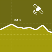
Terrain Radar
Mapping & elevation data tools
开发者: MYSTIC MOBILE APPS LLC
中国

版本统计
125天1小时
最新版本上线距今
4
近1年版本更新次数
2024-11-27
全球最早版本上线日期
版本记录
版本: 1.12
版本更新日期
2025-03-11

Terrain Radar
Mapping & elevation data tools
更新日志
- bug fixes应用描述
Discover the Power of Terrain with Terrain Radar!
Unlock the potential of precise elevation measurements with Terrain Radar, the go-to app for professionals and outdoor enthusiasts alike. Whether you’re a hiker, biker, surveyor, or civil engineer, this app delivers essential topography insights at your fingertips.
Why Terrain Radar?
Imagine having a powerful radar for the terrain around you. With Terrain Radar, you can explore detailed elevation data and visualize it on a sleek graph and interactive map. Measure distances ranging from as short as 300 feet to as far as 6 miles. Want to change direction? Simply use your phone's sensors or set the direction manually within the app's intuitive interface.
Key Features:
- Accurate Elevation Mapping: Get real-time elevation data displayed on a customizable map. Perfect for understanding terrain profiles for hiking, urban planning, and more.
- Adjustable Distance: Control the distance you want to measure—from 300 feet to a maximum of 6 miles, offering flexibility for any task.
- Built-in Compass: Always know your bearings with the integrated compass, designed to help you navigate and adjust directions for accurate measurements.
- Versatile Mapping Options: Choose from a variety of map formats to suit your preference, and measure not only in your current location but anywhere on the map.
- Share Your Findings: Easily share your measurement data in the form of photos. Share stunning snapshots of terrain measurements with colleagues, friends, or clients.
- Customizable Settings: Select between metric and imperial units depending on your needs, and experience seamless integration for various professional fields, from geology to forestry management.
- Comprehensive Tutorial: New to Terrain Radar? No problem! The built-in tutorial guides you step-by-step, making sure you can use all of the app’s powerful features with ease.
Designed for Professionals & Adventurers From geologists and urban planners to environmental scientists and outdoor guides, Terrain Radar offers powerful tools for those who rely on detailed terrain and topography insights. Whether you’re exploring new paths or assessing land for development, our app is your trusted companion.
Experience the best in terrain mapping, gain deeper insights, and stay ahead of the curve with Terrain Radar.
Download now and transform the way you see the world beneath your feet!
Privacy Policy: https://mysticmobileapps.com/legal/privacy/terrainradar
Terms and conditions: https://mysticmobileapps.com/legal/terms/terrainradar版本: 1.11
版本更新日期
2025-01-08

Terrain Radar
Mapping & elevation data tools
更新日志
- bug fixes应用描述
Discover the Power of Terrain with Terrain Radar!
Unlock the potential of precise elevation measurements with Terrain Radar, the go-to app for professionals and outdoor enthusiasts alike. Whether you’re a hiker, biker, surveyor, or civil engineer, this app delivers essential topography insights at your fingertips.
Why Terrain Radar?
Imagine having a powerful radar for the terrain around you. With Terrain Radar, you can explore detailed elevation data and visualize it on a sleek graph and interactive map. Measure distances ranging from as short as 300 feet to as far as 6 miles. Want to change direction? Simply use your phone's sensors or set the direction manually within the app's intuitive interface.
Key Features:
- Accurate Elevation Mapping: Get real-time elevation data displayed on a customizable map. Perfect for understanding terrain profiles for hiking, urban planning, and more.
- Adjustable Distance: Control the distance you want to measure—from 300 feet to a maximum of 6 miles, offering flexibility for any task.
- Built-in Compass: Always know your bearings with the integrated compass, designed to help you navigate and adjust directions for accurate measurements.
- Versatile Mapping Options: Choose from a variety of map formats to suit your preference, and measure not only in your current location but anywhere on the map.
- Share Your Findings: Easily share your measurement data in the form of photos. Share stunning snapshots of terrain measurements with colleagues, friends, or clients.
- Customizable Settings: Select between metric and imperial units depending on your needs, and experience seamless integration for various professional fields, from geology to forestry management.
- Comprehensive Tutorial: New to Terrain Radar? No problem! The built-in tutorial guides you step-by-step, making sure you can use all of the app’s powerful features with ease.
Designed for Professionals & Adventurers From geologists and urban planners to environmental scientists and outdoor guides, Terrain Radar offers powerful tools for those who rely on detailed terrain and topography insights. Whether you’re exploring new paths or assessing land for development, our app is your trusted companion.
Experience the best in terrain mapping, gain deeper insights, and stay ahead of the curve with Terrain Radar.
Download now and transform the way you see the world beneath your feet!
Privacy Policy: https://mysticmobileapps.com/legal/privacy/terrainradar
Terms and conditions: https://mysticmobileapps.com/legal/terms/terrainradar版本: 1.10
版本更新日期
2024-11-28
Terrain Radar
Mapping & elevation data tools
更新日志
- bug fixes应用描述
Discover the Power of Terrain with Terrain Radar!
Unlock the potential of precise elevation measurements with Terrain Radar, the go-to app for professionals and outdoor enthusiasts alike. Whether you’re a hiker, biker, surveyor, or civil engineer, this app delivers essential topography insights at your fingertips.
Why Terrain Radar?
Imagine having a powerful radar for the terrain around you. With Terrain Radar, you can explore detailed elevation data and visualize it on a sleek graph and interactive map. Measure distances ranging from as short as 300 feet to as far as 6 miles. Want to change direction? Simply use your phone's sensors or set the direction manually within the app's intuitive interface.
Key Features:
- Accurate Elevation Mapping: Get real-time elevation data displayed on a customizable map. Perfect for understanding terrain profiles for hiking, urban planning, and more.
- Adjustable Distance: Control the distance you want to measure—from 300 feet to a maximum of 6 miles, offering flexibility for any task.
- Built-in Compass: Always know your bearings with the integrated compass, designed to help you navigate and adjust directions for accurate measurements.
- Versatile Mapping Options: Choose from a variety of map formats to suit your preference, and measure not only in your current location but anywhere on the map.
- Share Your Findings: Easily share your measurement data in the form of photos. Share stunning snapshots of terrain measurements with colleagues, friends, or clients.
- Customizable Settings: Select between metric and imperial units depending on your needs, and experience seamless integration for various professional fields, from geology to forestry management.
- Comprehensive Tutorial: New to Terrain Radar? No problem! The built-in tutorial guides you step-by-step, making sure you can use all of the app’s powerful features with ease.
Designed for Professionals & Adventurers From geologists and urban planners to environmental scientists and outdoor guides, Terrain Radar offers powerful tools for those who rely on detailed terrain and topography insights. Whether you’re exploring new paths or assessing land for development, our app is your trusted companion.
Experience the best in terrain mapping, gain deeper insights, and stay ahead of the curve with Terrain Radar.
Download now and transform the way you see the world beneath your feet!
Privacy Policy: https://mysticmobileapps.com/legal/privacy/terrainradar
Terms and conditions: https://mysticmobileapps.com/legal/terms/terrainradar预订版本: 1.0
版本更新日期
2024-11-27
预订转上架日期
2024-11-27Terrain Radar
Mapping & elevation data tools
更新日志
暂无更新日志数据
应用描述
暂无应用描述数据


微信公众号

七麦数据公众号

七麦研究院公众号
APP下载
- IOS
- Android

@2014-2022 qimai.cn,北京七麦科技股份有限公司 All Rights Reserved. 京ICP备14049953号
 京公网安备 11010502041000号


