


 关联应用
关联应用

NRST
Descent Rate & Airport Finder
开发者: Toonsy Net

339天23小时
最新版本上线距今
1
近1年版本更新次数
2014-03-07
全球最早版本上线日期
版本: 8.0
版本更新日期
2024-09-18
NRST
Descent Rate & Airport Finder
更新日志
Updates for iOS 18视频/截图
应用描述
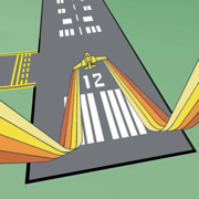
Don't miss your airport! Designed for pilots of any size aircraft, this app provides you with bearing and vertical speed required to nearby airports. The following information is shown for destinations:
• Distance from current location
• Field Elevation
• Descent rate required
• Time to Top of Descent (TOD)
• Bearing
• Frequencies
• Runways
• Glide distance delta
Additionally your current speed, course, altitude and vertical speed are displayed. Tapping on the information button, Time to TOD or Target Altitude allows you to customize the desired descent rate.
All data is updated in real time as you fly. You may choose a nearby airport or select an airport by identifier by scrolling down on the airport list. Filter by runway length and surface type and choose any of the following: airports, seaplane bases, heliports, balloon ports and closed airports.
You may optionally provide a glide ratio for your aircraft. The glide distance long or short of the selected airport is then displayed and is conveniently color coded. A positive, green glide delta indicates the glide distance has been estimated to exceed the distance to the airport with a 25% safety margin.
Runway headings, if known, are used to draw runways on the heading indicator. If the magenta arrow is pointed straight up and aligned with a runway then you are headed straight in.
Worldwide airport information is provided by multiple sources. Canada, Europe and all continents are covered! For more information go to ourairports.com/world.html. Database updates are performed daily.
Your location and altitude is provided by your device's location services. If location or altitude is not available that information will not be displayed however you can still search for an airport by identifier. Unfortunately external GPS devices are generally NOT compatible.
You must be moving for course information and the magenta relative bearing arrow to be displayed.
The Watch app has many of the same features and fits on your wrist. See distances to nearby airports or bearing to a selected airport. Frequencies and runway lengths can be seen with a swipe. A green glide icon or delta indicates glideability is likely.
Just like the iPhone and iPad app, the Watch app requires GPS information to locate nearby airports and relative bearing. Additionally, altitude is needed to calculate descent rates.
Feedback and feature requests are appreciated. Thanks!
Subscription Fine Print
----------------------
- 1 month FREE trial
- Database Subscription or Apple Watch Subscription is required for new users
- The subscription is for 1 year and updated data is available daily
- The annual subscription is $11.99/year or $17.99/year for Watch
- Payment will be charged to iTunes Account at confirmation of purchase
- Subscription automatically renews unless auto-renew is turned off at least 24-hours before the end of the current period
- Account will be charged for renewal within 24-hours prior to the end of the current period, and identify the cost of the renewal
- Subscriptions may be managed by the user and auto-renewal may be turned off by going to the user's Account Settings after purchase
- No cancellation of the current subscription is allowed during active subscription period
- Privacy policy and terms of use are located at: http://toonsy.net/privacy.html
- Any unused portion of a free trial period, if offered, will be forfeited when the user purchases a subscription to that publication.版本: 7.3
版本更新日期
2024-01-23
NRST
Descent Rate & Airport Finder
更新日志
Minor bug fixes视频/截图
应用描述
Don't miss your airport! Designed for pilots of any size aircraft, this app provides you with bearing and vertical speed required to nearby airports. The following information is shown for destinations:
• Distance from current location
• Field Elevation
• Descent rate required
• Time to Top of Descent (TOD)
• Bearing
• Frequencies
• Runways
• Glide distance delta
Additionally your current speed, course, altitude and vertical speed are displayed. Tapping on the information button, Time to TOD or Target Altitude allows you to customize the desired descent rate.
All data is updated in real time as you fly. You may choose a nearby airport or select an airport by identifier by scrolling down on the airport list. Filter by runway length and surface type and choose any of the following: airports, seaplane bases, heliports, balloon ports and closed airports.
You may optionally provide a glide ratio for your aircraft. The glide distance long or short of the selected airport is then displayed and is conveniently color coded. A positive, green glide delta indicates the glide distance has been estimated to exceed the distance to the airport with a 25% safety margin.
Runway headings, if known, are used to draw runways on the heading indicator. If the magenta arrow is pointed straight up and aligned with a runway then you are headed straight in.
Worldwide airport information is provided by multiple sources. Canada, Europe and all continents are covered! For more information go to ourairports.com/world.html. Database updates are performed daily.
Your location and altitude is provided by your device's location services. If location or altitude is not available that information will not be displayed however you can still search for an airport by identifier. Unfortunately external GPS devices are generally NOT compatible.
You must be moving for course information and the magenta relative bearing arrow to be displayed.
The Watch app has many of the same features and fits on your wrist. See distances to nearby airports or bearing to a selected airport. Frequencies and runway lengths can be seen with a swipe. A green glide icon or delta indicates glideability is likely.
Just like the iPhone and iPad app, the Watch app requires GPS information to locate nearby airports and relative bearing. Additionally, altitude is needed to calculate descent rates.
Feedback and feature requests are appreciated. Thanks!
Subscription Fine Print
----------------------
- 1 month FREE trial
- Database Subscription or Apple Watch Subscription is required for new users
- The subscription is for 1 year and updated data is available daily
- The annual subscription is $11.99/year or $17.99/year for Watch
- Payment will be charged to iTunes Account at confirmation of purchase
- Subscription automatically renews unless auto-renew is turned off at least 24-hours before the end of the current period
- Account will be charged for renewal within 24-hours prior to the end of the current period, and identify the cost of the renewal
- Subscriptions may be managed by the user and auto-renewal may be turned off by going to the user's Account Settings after purchase
- No cancellation of the current subscription is allowed during active subscription period
- Privacy policy and terms of use are located at: http://toonsy.net/privacy.html
- Any unused portion of a free trial period, if offered, will be forfeited when the user purchases a subscription to that publication.版本: 7.2
版本更新日期
2023-07-07
NRST
Descent Rate & Airport Finder
更新日志
OS compatibility updates应用描述
暂无应用描述数据
版本: 7.1
版本更新日期
2022-10-18

NRST
Descent Rate & Airport Finder
更新日志
Added Apple Watch complications视频/截图
应用描述
Don't miss your airport! Designed for pilots of any size aircraft, this app provides you with bearing and vertical speed required to nearby airports. The following information is shown for destinations:
• Distance from current location
• Field Elevation
• Descent rate required
• Time to Top of Descent (TOD)
• Bearing
• Frequencies
• Runways
• Glide distance delta
Additionally your current speed, course, altitude and vertical speed are displayed. Tapping on the information button, Time to TOD or Target Altitude allows you to customize the desired descent rate.
All data is updated in real time as you fly. You may choose a nearby airport or select an airport by identifier by scrolling down on the airport list. Filter by runway length and surface type and choose any of the following: airports, seaplane bases, heliports, balloon ports and closed airports.
You may optionally provide a glide ratio for your aircraft. The glide distance long or short of the selected airport is then displayed and is conveniently color coded. A positive, green glide delta indicates the glide distance has been estimated to exceed the distance to the airport with a 25% safety margin.
Runway headings, if known, are used to draw runways on the heading indicator. If the magenta arrow is pointed straight up and aligned with a runway then you are headed straight in.
Worldwide airport information is provided by multiple sources. Canada, Europe and all continents are covered! For more information go to ourairports.com/world.html. Database updates are performed daily.
Your location and altitude is provided by your device's location services. If location or altitude is not available that information will not be displayed however you can still search for an airport by identifier. Unfortunately external GPS devices are generally NOT compatible.
You must be moving for course information and the magenta relative bearing arrow to be displayed.
The Watch app has many of the same features and fits on your wrist. See distances to nearby airports or bearing to a selected airport. Frequencies and runway lengths can be seen with a swipe. A green glide icon or delta indicates glideability is likely.
Just like the iPhone and iPad app, the Watch app requires GPS information to locate nearby airports and relative bearing. Additionally, altitude is needed to calculate descent rates. All watch versions are supported. Watch 1 requires an iPhone for GPS signal however a Watch 2 has it's own GPS.
Feedback and feature requests are appreciated. Thanks!
Subscription Fine Print
----------------------
- 1 month FREE trial
- Database Subscription or Apple Watch Subscription is required for new users
- The subscription is for 1 year and updated data is available daily
- The annual subscription is $11.99/year or $17.99/year for Watch
- Payment will be charged to iTunes Account at confirmation of purchase
- Subscription automatically renews unless auto-renew is turned off at least 24-hours before the end of the current period
- Account will be charged for renewal within 24-hours prior to the end of the current period, and identify the cost of the renewal
- Subscriptions may be managed by the user and auto-renewal may be turned off by going to the user's Account Settings after purchase
- No cancellation of the current subscription is allowed during active subscription period
- Privacy policy and terms of use are located at: http://toonsy.net/privacy.html
- Any unused portion of a free trial period, if offered, will be forfeited when the user purchases a subscription to that publication.版本: 7.0
版本更新日期
2022-09-20

NRST
Descent Rate & Airport Finder
更新日志
Updates for iOS 16视频/截图
应用描述
Don't miss your airport! Designed for pilots of any size aircraft, this app provides you with bearing and vertical speed required to nearby airports. The following information is shown for destinations:
• Distance from current location
• Field Elevation
• Descent rate required
• Time to Top of Descent (TOD)
• Bearing
• Frequencies
• Runways
• Glide distance delta
Additionally your current speed, course, altitude and vertical speed are displayed. Tapping on the information button, Time to TOD or Target Altitude allows you to customize the desired descent rate.
All data is updated in real time as you fly. You may choose a nearby airport or select an airport by identifier by scrolling down on the airport list. Filter by runway length and surface type and choose any of the following: airports, seaplane bases, heliports, balloon ports and closed airports.
You may optionally provide a glide ratio for your aircraft. The glide distance long or short of the selected airport is then displayed and is conveniently color coded. A positive, green glide delta indicates the glide distance has been estimated to exceed the distance to the airport with a 25% safety margin.
Runway headings, if known, are used to draw runways on the heading indicator. If the magenta arrow is pointed straight up and aligned with a runway then you are headed straight in.
Worldwide airport information is provided by multiple sources. Canada, Europe and all continents are covered! For more information go to ourairports.com/world.html. Database updates are performed daily.
Your location and altitude is provided by your device's location services. If location or altitude is not available that information will not be displayed however you can still search for an airport by identifier. Unfortunately external GPS devices are generally NOT compatible.
You must be moving for course information and the magenta relative bearing arrow to be displayed.
The Watch app has many of the same features and fits on your wrist. See distances to nearby airports or bearing to a selected airport. Frequencies and runway lengths can be seen with a swipe. A green glide icon or delta indicates glideability is likely.
Just like the iPhone and iPad app, the Watch app requires GPS information to locate nearby airports and relative bearing. Additionally, altitude is needed to calculate descent rates. All watch versions are supported. Watch 1 requires an iPhone for GPS signal however a Watch 2 has it's own GPS.
Feedback and feature requests are appreciated. Thanks!
Subscription Fine Print
----------------------
- 1 month FREE trial
- Database Subscription or Apple Watch Subscription is required for new users
- The subscription is for 1 year and updated data is available daily
- The annual subscription is $11.99/year or $17.99/year for Watch
- Payment will be charged to iTunes Account at confirmation of purchase
- Subscription automatically renews unless auto-renew is turned off at least 24-hours before the end of the current period
- Account will be charged for renewal within 24-hours prior to the end of the current period, and identify the cost of the renewal
- Subscriptions may be managed by the user and auto-renewal may be turned off by going to the user's Account Settings after purchase
- No cancellation of the current subscription is allowed during active subscription period
- Privacy policy and terms of use are located at: http://toonsy.net/privacy.html
- Any unused portion of a free trial period, if offered, will be forfeited when the user purchases a subscription to that publication.版本: 6.3
版本更新日期
2021-03-09

NRST
Descent Rate & Airport Finder
更新日志
• Increased maximum target altitude
• Updates for iOS 14视频/截图
应用描述
Don't miss your airport! Designed for pilots of any size aircraft, this app provides you with bearing and vertical speed required to nearby airports. The following information is shown for destinations:
• Distance from current location
• Field Elevation
• Descent rate required
• Time to Top of Descent (TOD)
• Bearing
• Frequencies
• Runways
• Glide distance delta
Additionally your current speed, course, altitude and vertical speed are displayed. Tapping on the information button, Time to TOD or Target Altitude allows you to customize the desired descent rate.
All data is updated in real time as you fly. You may choose a nearby airport or select an airport by identifier by scrolling down on the airport list. Filter by runway length and surface type and choose any of the following: airports, seaplane bases, heliports, balloon ports and closed airports.
You may optionally provide a glide ratio for your aircraft. The glide distance long or short of the selected airport is then displayed and is conveniently color coded. A positive, green glide delta indicates the glide distance has been estimated to exceed the distance to the airport with a 25% safety margin.
Runway headings, if known, are used to draw runways on the heading indicator. If the magenta arrow is pointed straight up and aligned with a runway then you are headed straight in.
Worldwide airport information is provided by multiple sources. Canada, Europe and all continents are covered! For more information go to ourairports.com/world.html. Database updates are performed daily.
Your location and altitude is provided by your device's location services. If location or altitude is not available that information will not be displayed however you can still search for an airport by identifier. Unfortunately external GPS devices are generally NOT compatible.
You must be moving for course information and the magenta relative bearing arrow to be displayed.
The Watch app has many of the same features and fits on your wrist. See distances to nearby airports or bearing to a selected airport. Frequencies and runway lengths can be seen with a swipe. A green glide icon or delta indicates glideability is likely.
Just like the iPhone and iPad app, the Watch app requires GPS information to locate nearby airports and relative bearing. Additionally, altitude is needed to calculate descent rates. All watch versions are supported. Watch 1 requires an iPhone for GPS signal however a Watch 2 has it's own GPS.
Feedback and feature requests are appreciated. Thanks!
Subscription Fine Print
----------------------
- 1 month FREE trial
- Database Subscription or Apple Watch Subscription is required for new users
- The subscription is for 1 year and updated data is available daily
- The annual subscription is $11.99/year or $17.99/year for Watch
- Payment will be charged to iTunes Account at confirmation of purchase
- Subscription automatically renews unless auto-renew is turned off at least 24-hours before the end of the current period
- Account will be charged for renewal within 24-hours prior to the end of the current period, and identify the cost of the renewal
- Subscriptions may be managed by the user and auto-renewal may be turned off by going to the user's Account Settings after purchase
- No cancellation of the current subscription is allowed during active subscription period
- Privacy policy and terms of use are located at: http://toonsy.net/privacy.html
- Any unused portion of a free trial period, if offered, will be forfeited when the user purchases a subscription to that publication.版本: 6.2
版本更新日期
2020-09-19

NRST
Descent Rate & Airport Finder
更新日志
• Improved database downloading
• Updates for iOS 13
• Moved free trial text below annual subscription text
• Removed other text emphasizing free trial
• Pricing information is prominent on 2 pages of the subscription flow视频/截图
应用描述
Don't miss your airport! Designed for pilots of any size aircraft, this app provides you with bearing and vertical speed required to nearby airports. The following information is shown for destinations:
• Distance from current location
• Field Elevation
• Descent rate required
• Time to Top of Descent (TOD)
• Bearing
• Frequencies
• Runways
• Glide distance delta
Additionally your current speed, course, altitude and vertical speed are displayed. Tapping on the information button, Time to TOD or Target Altitude allows you to customize the desired descent rate.
All data is updated in real time as you fly. You may choose a nearby airport or select an airport by identifier by scrolling down on the airport list. Filter by runway length and surface type and choose any of the following: airports, seaplane bases, heliports, balloon ports and closed airports.
You may optionally provide a glide ratio for your aircraft. The glide distance long or short of the selected airport is then displayed and is conveniently color coded. A positive, green glide delta indicates the glide distance has been estimated to exceed the distance to the airport with a 25% safety margin.
Runway headings, if known, are used to draw runways on the heading indicator. If the magenta arrow is pointed straight up and aligned with a runway then you are headed straight in.
Worldwide airport information is provided by multiple sources. Canada, Europe and all continents are covered! For more information go to ourairports.com/world.html. Database updates are performed daily.
Your location and altitude is provided by your device's location services. If location or altitude is not available that information will not be displayed however you can still search for an airport by identifier. Unfortunately external GPS devices are generally NOT compatible.
You must be moving for course information and the magenta relative bearing arrow to be displayed.
The Watch app has many of the same features and fits on your wrist. See distances to nearby airports or bearing to a selected airport. Frequencies and runway lengths can be seen with a swipe. A green glide icon or delta indicates glideability is likely.
Just like the iPhone and iPad app, the Watch app requires GPS information to locate nearby airports and relative bearing. Additionally, altitude is needed to calculate descent rates. All watch versions are supported. Watch 1 requires an iPhone for GPS signal however a Watch 2 has it's own GPS.
Feedback and feature requests are appreciated. Thanks!
Subscription Fine Print
----------------------
- 1 month FREE trial
- Database Subscription or Apple Watch Subscription is required for new users
- The subscription is for 1 year and updated data is available daily
- The annual subscription is $11.99/year or $17.99/year for Watch
- Payment will be charged to iTunes Account at confirmation of purchase
- Subscription automatically renews unless auto-renew is turned off at least 24-hours before the end of the current period
- Account will be charged for renewal within 24-hours prior to the end of the current period, and identify the cost of the renewal
- Subscriptions may be managed by the user and auto-renewal may be turned off by going to the user's Account Settings after purchase
- No cancellation of the current subscription is allowed during active subscription period
- Privacy policy and terms of use are located at: http://toonsy.net/privacy.html
- Any unused portion of a free trial period, if offered, will be forfeited when the user purchases a subscription to that publication.版本: 6.0
版本更新日期
2018-12-06

NRST
Descent Rate & Airport Finder
更新日志
Improved download progress tracking on Apple Watch视频/截图
应用描述
Don't miss your airport! Designed for pilots of any size aircraft, this app provides you with bearing and vertical speed required to nearby airports. The following information is shown for destinations:
• Distance from current location
• Field Elevation
• Descent rate required
• Time to Top of Descent (TOD)
• Bearing
• Frequencies
• Runways
• Glide distance delta
Additionally your current speed, course, altitude and vertical speed are displayed. Tapping on the information button, Time to TOD or Target Altitude allows you to customize the desired descent rate.
All data is updated in real time as you fly. You may choose a nearby airport or select an airport by identifier by scrolling down on the airport list. Filter by runway length and surface type and choose any of the following: airports, seaplane bases, heliports, balloon ports and closed airports.
You may optionally provide a glide ratio for your aircraft. The glide distance long or short of the selected airport is then displayed and is conveniently color coded. A positive, green glide delta indicates the glide distance has been estimated to exceed the distance to the airport with a 25% safety margin.
Runway headings, if known, are used to draw runways on the heading indicator. If the magenta arrow is pointed straight up and aligned with a runway then you are headed straight in.
Worldwide airport information is provided by multiple sources. Canada, Europe and all continents are covered! For more information go to ourairports.com/world.html. Database updates are performed daily.
Your location and altitude is provided by your device's location services. If location or altitude is not available that information will not be displayed however you can still search for an airport by identifier. Unfortunately external GPS devices are generally NOT compatible.
You must be moving for course information and the magenta relative bearing arrow to be displayed.
The Watch app has many of the same features and fits on your wrist. See distances to nearby airports or bearing to a selected airport. Frequencies and runway lengths can be seen with a swipe. A green glide icon or delta indicates glideability is likely.
Just like the iPhone and iPad app, the Watch app requires GPS information to locate nearby airports and relative bearing. Additionally, altitude is needed to calculate descent rates. Apple Watch 1, 2, 3 and 4 are supported. Watch 1 requires an iPhone for GPS signal however a Watch 2 has it's own GPS.
Feedback and feature requests are appreciated. Thanks!
Subscription Fine Print
----------------------
- 1 month FREE trial
- Database Subscription or Apple Watch Subscription is required for new users
- The subscription is for 1 year and updated data is available daily
- The annual subscription is $11.99/year or $17.99/year for Watch
- Payment will be charged to iTunes Account at confirmation of purchase
- Subscription automatically renews unless auto-renew is turned off at least 24-hours before the end of the current period
- Account will be charged for renewal within 24-hours prior to the end of the current period, and identify the cost of the renewal
- Subscriptions may be managed by the user and auto-renewal may be turned off by going to the user's Account Settings after purchase
- No cancellation of the current subscription is allowed during active subscription period
- Privacy policy and terms of use are located at: http://toonsy.net/privacy.html
- Any unused portion of a free trial period, if offered, will be forfeited when the user purchases a subscription to that publication.版本: 5.9
版本更新日期
2018-11-14
NRST
Descent Rate & Airport Finder
更新日志
Performance improvements for Apple Watch应用描述
暂无应用描述数据
版本: 5.8
版本更新日期
2018-10-05
NRST
Descent Rate & Airport Finder
更新日志
• Apple Watch performance has improved
• There are now more animations on Apple Watch
• GPS data is now displayed longer with an hourglass to indicate data is not timely应用描述
暂无应用描述数据


微信公众号

七麦数据公众号

七麦研究院公众号
APP下载
- IOS
- Android

@2014-2022 qimai.cn,北京七麦科技股份有限公司 All Rights Reserved. 京ICP备14049953号
 京公网安备 11010502041000号


